
Want to know the best time to hike in the Wood River Valley?
Are you here for the avalanche butt sliding video? >> Go HERE.
When it is overcast.
That’s right, full blown sunny days are not the best days to hike in my strong opinion. It can be rather warm when the sun is in its full glory. Especially when you have a black lab 😁.

But when it is overcast and looks like it is not going to rain (and thunder / lightning), then you can go out just about any time of day for a great hike.
Speaking of a great hike …
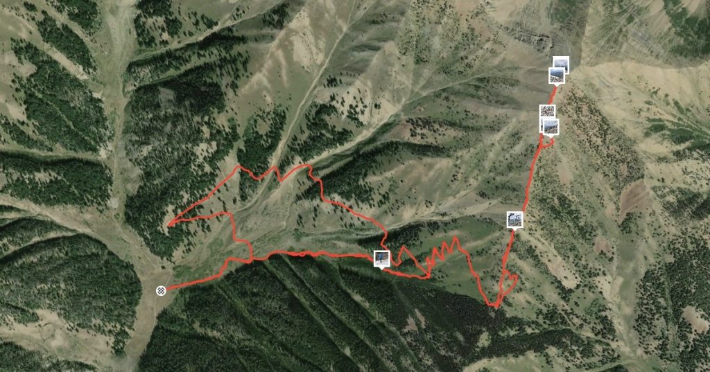
Lake Creek High Ridge Trail
What surprised me the most about this trail to the ridge line is that it is mostly a two track road.
From the trailhead to approximately 2.1 miles (3.4 kilometers) you are on an old two track road.
It certainly doesn’t seem like that the whole way.
Starting out is a fairly obvious, wide, overgrown trail. It veers left at 0.3 miles (0.5 km) for a gradual slope up, followed by a sharp right at 0.8 miles (1.3 km).
For the most part the trail is very wide, though over grown for the first 1.3 miles (2.1 km).
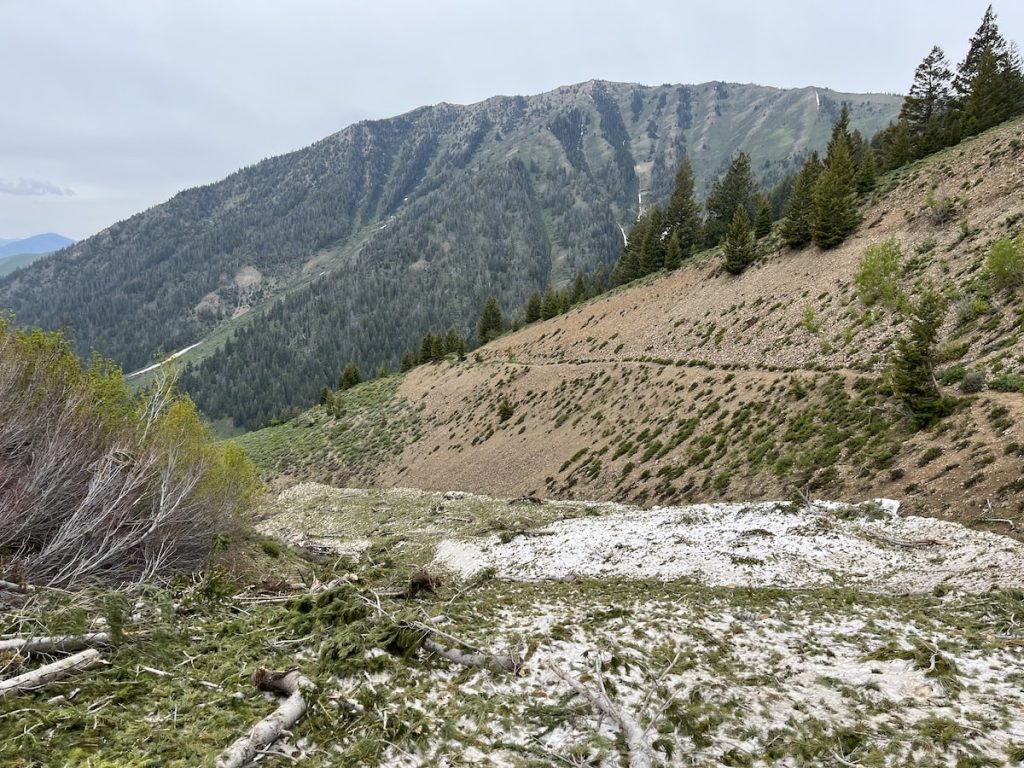
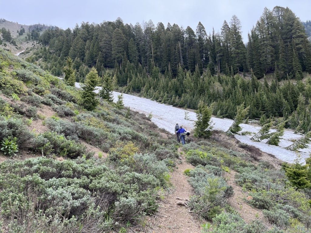
Then just before you get to an established avalanche path at 1.3 miles (2.1 km) the trail is barely there as rocks have slid down to cover a good chunk of the trail
Looking back at the avalanche path we just crossed and the trail that is barely there anymore 👇.
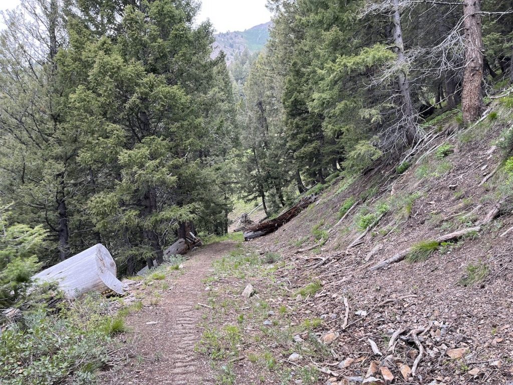
As soon as you are in the woods, it is back to a major highway at 1.4 miles (2.3 km).
Enough about the trail width – I think you get the point.
Avalanches
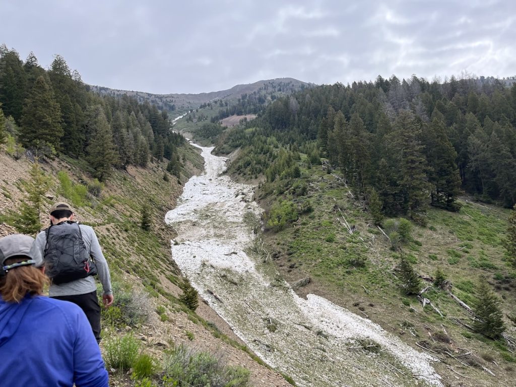
Since we did this hike on June 17th, we had to cross a few avalanche paths.
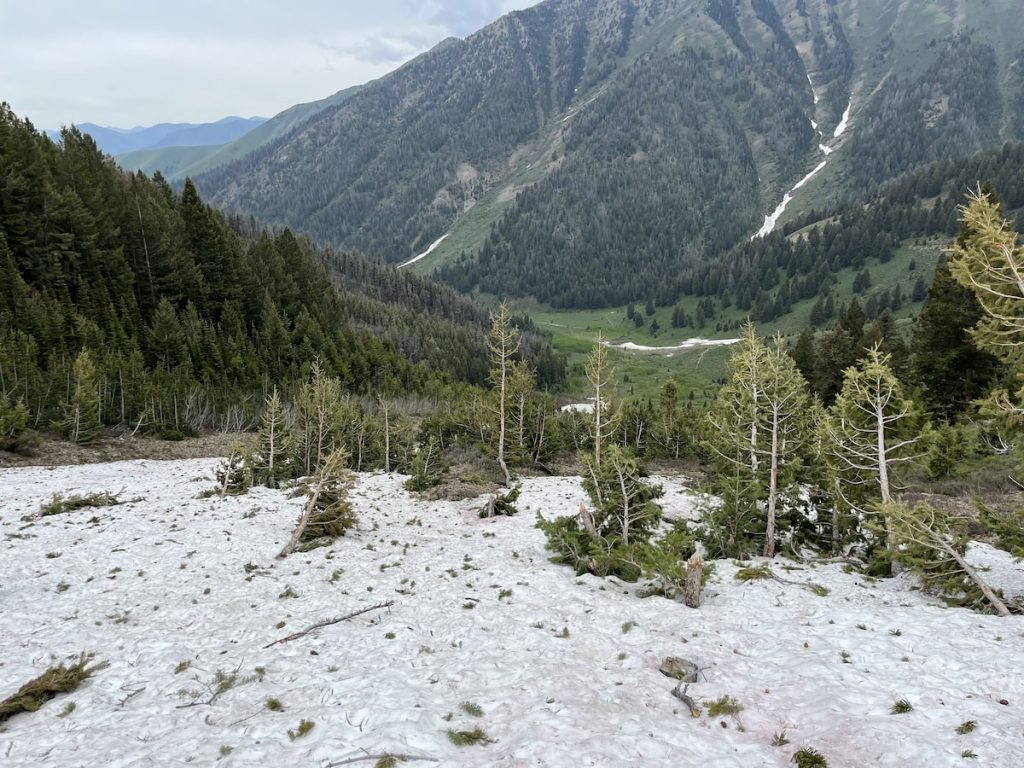
For the most part, no big deal.
At this time of year the snow is can be done sliding and avalanche snow is usually compacted well making it so that you do NOT post hole. No guarantees, but that is what we have found (and another reason to hike on a overcast day).
Switchbacks
There are nine switchbacks of varying length that zig zag up from the two track road to the ridge.
The beloved two track road turns into a faint memory as the trail gets steeper and narrower to the ridge line.
First switchback starts at the 2.1 miles mark (3.4 km) at 8,148′ (2484 m) and ends at the saddle at the 3.2 miles mark (5.1 km) at 9,050′ (2758 m).
Ridgeline
You will know when you are there.
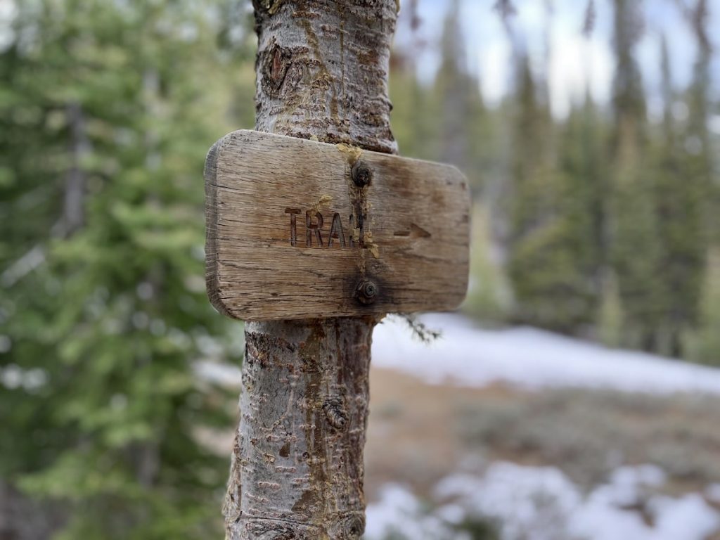
This will be the first time in a long time that there is flat ground.
If for some reason you are thinking of camping, right by the trail sign (that one that says “Trail”) is the perfect spot (once the snow is gone).
From here, the High Ridge Trail continues on the other side of the mountain towards Trail Creek Summit. At this point you have done the steepest part of the trail (the switchbacks).
Instead of following the trail, some of us (not me and not the dog) continued up the ridge line to what seemed to be the highest summit in the area, approximately 1.2 miles (1.9 km) further at 10,440′ (3182 m).
Avalanche Butt Sliding
On the way down, if you want to save ~1 mile (~1.6 km) of hiking, consider butt sliding an avalanche.
Of course, this depends on the conditions.
I can’t in good parenting consciousness recommend doing this, but it is a ton of fun!
Stats
- Start: 6,908′ (2106 m)
- Switchbacks: 8,148′ (2484 m), 2.1 miles (3.4 km), 1:18
- Ridge: 9,050′ (2758 m), 3.2 miles (5.1 km), 2:00
- Summit: 10,440′ (3182 m), 4.4 miles (7.1 km), 3:04
- Total moving time = 5:26
- Total time = 6:25